
Technical Reference – GPS Real Life Flight Recordings
Introduction
Tacview is a great training tool when used with flight simulations; it can be – as well – used for real life flights training and debriefing! It is as simple as exporting your flights in the widely supported GPX (GPS Exchange Format) file format and opening them in Tacview.
From transcontinental flights to local traffic patterns, review and analyse at a glimpse any real-life flight! Visualize as many aircraft as you want in the same world and enjoy the power of all the analysis tools offered by Tacview.
While the current version of Tacview can only analyse a flight after it has been completed, Tacview 2.0 will enable you to analyse any flight in progress including the ones currently recorded by your GPS, and such, at no additionnal cost!
How to use Tacview with my GPS?
The use of each specific GPS is beyond the scope of this article. However, almost all modern GPS are offering an option to record and export tracking data in the universal GPX file format. With most GPS, all you have to do, is to connect your device to a computer, import the .gpx files of your choice, and open them in Tacview.
Of course! You can open an unlimited amount of GPX files at once and even use the dedicated function to merge additional files afterward. You will then see each recorded track displayed in the same 3D world.
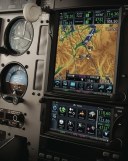
You can use Tacview with any GPS able to record and export your flights in the GPX file format. If you are using flight decks like the Garmin G1000, you should instead consider the CSV file format which is natively supported by Tacview.
You need Tacview Standard or above to be able to open .gpx files.
General Questions
You can easily display the proper aircraft name and shape in the 3D view by changing the name of the corresponding GPS track (for example: C-172R Skyhawk). The same way, you can also change the track color. All of this can easily be accomplished using a GPX file editor such as Garmin BaseCamp or by manually editing the GPX file using a raw text editor like Notepad++.
<?xml version="1.0" encoding="utf-8"?><?xml version="1.0" encoding="utf-8"?>
<gpx version="1.1">
  <trk>
    <name>C-172R Skyhawk (Lt. Topper Harley)</name>
    <extensions>
      <gpxx:TrackExtension>
        <gpxx:DisplayColor>Blue</gpxx:DisplayColor>
      </gpxx:TrackExtension>
    </extensions>
    <trkseg>
      ...
    </trkseg>
  </trk>
</gpx>By default, Tacview offers a low-resolution ETOP1 worldwide coverage. You can download – for free – higher resolution SRTM3 terrain in the add-ons section of this website. If your favorite region is not yet covered, you can easily download and import any SRTM1 and SRTM3 data from NASA by following the provided instructions.
If your GPS cannot export your flight in the GPX file format, you should consider the CSV file format. More technical skills are required to generate a .csv file, but it may be easier to convert proprietary data into this format.
GPX files usually contain only a limited amount of distinct information. For instance, they may typically not contain aircraft orientation data like roll, pitch, and yaw. If you want to analyse this kind of data accurately, then you should consider the CSV file format which is more technical and comprehensive. If the limitation is coming from your GPS, you may also want to consider buying a more advanced recording device producing more complete files like the Stratus 2S.