
Technical Reference – KML Real Life Flight Recordings
Introduction
While GPX files recorded by GPS are great for a first flight analysis, they lack important data like aircraft attitude. In that domain, nothing come close to the new generation of devices available on the market today.
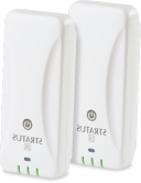
For example, the Stratus 2S is convenient and offers accurate flight data recording including – not only your position – but also your aircraft complete attitude (roll, pitch and yaw). With such device, after each flight, all you have to do, is to export your data in the widely supported KML (Keyhole Markup Language) file format and load it in Tacview to review accurately your performances and exact trajectories!
You should give a try and experiment with FlightAware flight recordings from real-life. Just open a flight and click on the little Google Earth icon to export the data. Do not forget that you can merge and review multiple flights at once in Tacview! Please note that because of ADS-B limitation, takeoffs and landings are often not recorded in FlightAware.
KML files are also a handy way to add static objects in Tacview world. Please read below to see how.
While the current version of Tacview can only analyse a flight after it has been completed, Tacview 2.0 will enable you to analyse any flight in progress including the ones currently recorded by your device, and such, at no additionnal cost!
How to use Tacview with my device?
The use of each specific device is beyond the scope of this article. However, many modern devices are offering an option to record and export tracking data in the universal KML file format. With most devices, all you have to do, is to connect your it to a computer, import the .kml files of your choice, and open them in Tacview.
Of course! You can open an unlimited amount of KML files at once and even use the dedicated function to merge additional files afterward. You will then see each recorded track displayed in the same 3D world.
You can use Tacview with any device able to record and export your flights in the KML file format like the Stratus 2S.
You need Tacview Standard or above to be able to open .kml files.
Static Objects
Tacview will automatically load and display any object declared in any .kml file stored in the sub-folders of your choice under: %ProgramData%\Tacview\Data\Static Objects\ or %APPDATA%\Tacview\Data\Static Objects\
Please refer to the dedicated documentation to learn more about static objects.
General Questions
It is relatively easy to change the aircraft name and color using a program like Google Earth. You can also manually create and edit the corresponding XML fields using a text editor. Here is a sample of the fields used to change the flight/aircraft appearance in Tacview:
<?xml version="1.0" encoding="UTF-8"?>
<kml xmlns="http://www.opengis.net/kml/2.2" xmlns:gx="http://www.google.com/kml/ext/2.2">
	<Document>
		<name>FlightAware ✈ UAL1881 ✈ 30-Nov-2015  ✈ KIAD - KSFO</name>
		<Style id="trackStyle">
			<LineStyle>
				<color>ffDB9034</color>
			</LineStyle>
		</Style>
		<Placemark>
			<name>A320</name>
			<description>KIAD - KSFO</description>
			<gx:Track>...</gx:Track>
		</Placemark>
		<ExtendedData>
			<Data name="source">
				<value>FlightAware</value>
			</Data>
			<Data name="GPSModelName">
				<value>ADS-B</value>
			</Data>
			<Data name="flightTitle">
				<value>KIAD - KSFO</value>
			</Data>
			<Data name="pilotName">
				<value/>
			</Data>
			<Data name="tailNumber">
				<value>UAL1881</value>
			</Data>
			<Data name="pilotNotes">
				<value/>
			</Data>
		</ExtendedData>
	</Document>
</kml>By default, Tacview offers a low-resolution ETOP1 worldwide coverage. You can download – for free – higher resolution SRTM3 terrain in the add-ons section of this website. If your favorite region is not yet covered, you can easily download and import any SRTM1 and SRTM3 data from NASA by following the provided instructions.
It is important to understand that Tacview needs real telemetry data to do proper analysis. Some programs and GPS are exporting .kml files which are literally just drawings of your aircraft trajectory. While these files can be displayed in Google Earth for example, they cannot be used for a real debriefing.